Welcome
to the Island of Saba, part of Netherlands Antilles, in the Caribbean -
LukeTravels.com™
Main Page
 About the Island of Saba
Around the Island
Diving in Saba
How to get to Saba
Map of the Island
Airfare & Hotel Info
Contact
Us
Advertise
Here
LukeTravels.com Home
Page
Guide to Amsterdam - Holland
Guide to St. Maarten - Netherlands Antilles
About the Island of Saba
Around the Island
Diving in Saba
How to get to Saba
Map of the Island
Airfare & Hotel Info
Contact
Us
Advertise
Here
LukeTravels.com Home
Page
Guide to Amsterdam - Holland
Guide to St. Maarten - Netherlands Antilles
SABA - AROUND
THE ISLAND
 |
 |
There are no public buses and no scooters or bicycles
for rent on Saba, which makes taxis (or your feet) the best way to go. Taxis usually meet
flights; fares are fixed by the government.
Saba has very narrow and steep roads that may intimidate some drivers.
Even Sabans are
challenged by tight corners in Windwardside - you'd be hard pressed to find a car that
doesn't bear scrape marks from kissing at least one stone wall!
If you must have your own
vehicle, remember that there aren't many rental cars on the island so try to book in
advance. The main rental outlets are in Windwardside. Your home driver's license is valid
on Saba. The island's sole gas station is in Fort Bay. Drive on the right side of the
road.
Hitchhiking is a common means of transportation. In Windwardside, the main hitching spot
is near the wall by the Big Rock Market; in the Bottom it's by the Department of Public
Works.
|
SABA -
HELLS GATE
When you stand at the airport and look up the mountain, you see the village of Hell's
Gate, whose houses seem to cling precariously to the slopes. The road from the airport to
Windwardside passes directly through the village.
The main landmark in Hell's Gate is the Holy Rosary Church, a seemingly old stone church
built just three decades ago.
Behind the church, Hell's Gate Community Center sells the
best collection of Saba lace on the island as well as bottles of homemade Saba Spice
liqueur.
The ride from Hell's Gate to Windwardside is steep and winding. It passes through
a variety of terrains, offering some fine scenic views of Saba itself and glimpses of the
neighboring islands of Sint Eustatius, St Kitts, Nevis and St Barts.
SABA -
COVE BAY
Although the waters off Saba's east coast are often turbulent, Cove Bay, near the airport,
has a little boulder-protected pool that provides a safe spot for cooling off on a hot
day. The bay is reached after a five-minute walk along the side road that begins just
outside the terminal. Along the road into Cove Bay, there's a signposted trail leading
from an old leather factory (now a classroom for medical students) out along coastal
bluffs to some nice tidal pools at Flat Point, behind the airport. The hike takes about 15
minutes each way.
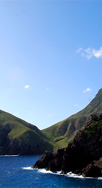
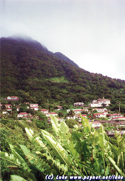
Saba | Windwardside & Mt.
Scenery covered in clouds
Photo Copyright © LukeTravels.com |
|
 |
SABA -
WINDWARDSIDE
The island's largest hamlet, Windwardside has curving alleyways lined with picturesque
cottages and flower-filled gardens. Being on the windward side of the island, just below
Mt Scenery, this hillside village is lush and green and a tad cooler than other parts of
the island. Windwardside makes the best base for visitors, as it has the most hotels,
restaurants and shops, as well as the tourist office, the museum, a good art gallery and
the trailhead to Mt Scenery.
|
While walking around you'll probably notice that many homes
have Dutch doors, the top halves of which are commonly kept open in the evening, allowing
people to chat from their living rooms with neighbors strolling by.
The Saba Museum is in a garden-like setting surrounded by wildflowers, including
black-eyed susans, the official island flower.
The museum is in a typical Saban home, whitewashed with
green-shuttered windows, and re-creates the living quarters of a
19th century Dutch sea captain. |
|
|
There's a four-poster bed with period decor, a collection of pottery
fragments, Amerindian hand tools and lots of memorabilia, including
maritime documents, sextants and a compass.
Windwardside is just east of the middle of the island, about halfway between Hell's Gate
and the Bottom, and connected to each by road.
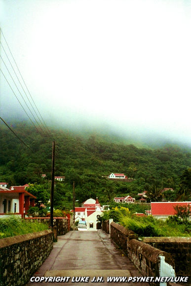
This is the Island of Saba |
View from our cottage & Mt. Scenery
Photo Copyright © LukeTravels.com
psynet.net/luke is a trademark
of
LukeTravels.com |
|
|
SABA - THE
BOTTOM
The Bottom is Saba's administrative center, but beyond that it's a quiet, lovely town. As
you first enter, you'll come upon the Department of Public Works, a former schoolhouse
flanked by tall night-blooming cacti that give off a wonderful fragrance in the evening.
On the next corner is the Anglican Church, a picturesque stone structure more than 200
years old. The town also has a couple of cobblestone streets lined with old stone walls.
The Bottom is located in the southwest corner of the
island. A kilometer-long road leads to Fort Bay, the island's commercial port, on the
southwestern coast. This winding section of road leads down through dry terrain punctuated
by Turk's-head cacti. Fort Bay has dive shops, the marine park office, the island's power
station, a water desalination plant and Saba's only gas station and hyper
baric chamber.
While there's no beach at Fort Bay, it's possible to join the local kids swimming at the
pier.
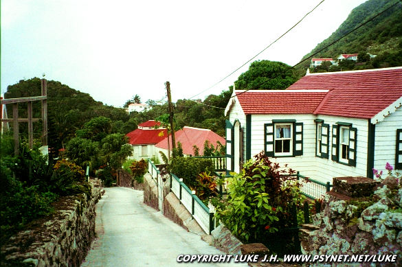
Saba | Windwardside cottage
house
Photo Copyright © LukeTravels.com
SABA - MT.
SCENERY
The island's premier hike is to the top of Mt Scenery, a strenuous climb up a virtual
nonstop run of stairs (1064 in all) that ends at the highest point in the Kingdom of the
Netherlands. The clearly marked trail begins at the side of the road a short walk west of
the tourist office in Windwardside. Hiking time is about 2-1/2 hours roundtrip. If you
rise early enough, the summit is a great place to watch the sun come up.
As ample reward for a good workout, you'll get a
close-up view of an elfin forest with its lush growth of ferns, tropical flowers and
epiphyte-covered mahogany trees, and if clouds don't roll in, the summit provides
panoramic views of Saba and neighboring islands. There are interpretive signboards along
the trail and a few shelters for shade - though it can get very hot a midday so be sure to
bring water. After reaching the summit, be sure to continue along the left side of the
radio tower to reach a scenic lookout 330ft beyond.
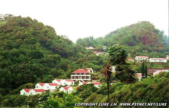
Saba | Windwardside
Photo Copyright © LukeTravels.com
For a quick sense of what Saban wilderness is like,
take the 45-minute roundtrip hike to Maskehorne Hill. After about ten minutes of climbing
old stone steps through a forest thick with tall elephant ears and birdsong, you'll reach
a small dasheen farm. At the farmer's hut, turn left off the Mt. Scenery Trail onto the Maskehorne Hill Trail, a dirt path through the forest that continues to nearby Maskehorne
Hill and a view of Windwardside.