Welcome
to the Island of Saba, part of Netherlands Antilles, in the Caribbean -
LukeTravels.com™
Main Page
 About the Island of Saba
Around the Island
Diving in Saba
How to get to Saba
Map of the Island
Airfare & Hotel Info
Contact
Us
Advertise
Here
LukeTravels.com Home
Page
Guide to Amsterdam - Holland
Guide to St. Maarten - Netherlands Antilles
About the Island of Saba
Around the Island
Diving in Saba
How to get to Saba
Map of the Island
Airfare & Hotel Info
Contact
Us
Advertise
Here
LukeTravels.com Home
Page
Guide to Amsterdam - Holland
Guide to St. Maarten - Netherlands Antilles
SABA - ABOUT
THE ISLAND OF SABA
 |
 |
Dubbed the 'Unspoiled
Queen,' low-key Saba (pronounced SAY-ba) has strikingly little
tourism. Both the smallest and loftiest of the Netherlands Antilles,
the island isn't a typical Caribbean powdered-sugar beach
destination - in fact, it has hardly any beaches at all.
Instead, ruggedly steep Saba
has beautiful scenery, good hiking and pristine diving. Its handful
of villages are spotlessly neat, close-knit and quiet - making Saba
better for peaceful unwinding than for rollicking nightlife.
Saba is located about 1225
miles southeast of
Miami, Florida, and 195
miles east of San Juan, Puerto Rico,
near the northern end of the Lesser Antilles. The island forms the
westernmost corner of a triangle of islands including
Sint Maarten (28mi northeast) and Sint Eustatius (20mi
southeast).
|
It's virtually impossible to get lost on Saba. There is
only one main road, which runs from the airport at the northeastern
side of the island through the villages of Hell's Gate, Windwardside,
St John's and the Bottom, and continues down to Fort Bay, the
island's main port. A second road connects the Bottom with Well's
Bay on the island's northwestern side.
| Shaped a bit like a heart (think anatomically, not Valentine's),
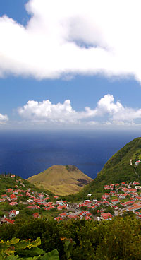
Saba's land area is small, but because of its topography of folding
mountains the island is far more substantial than any mere area
measurement would indicate. As the tip of an immense underwater
mountain, the island juts out of the sea with no pause for lowlands
or beaches. Saba's central volcanic peak, Mt Scenery, is 2900ft, its
summit cloaked in clouds.
There are no rivers or streams on the island. The leeward (western)
side is dry with cacti and scrub, the windward (eastern) side has
thicker vegetation and the mountainous interior is given over to
lush jungle growth such as tall tree ferns, palms and mahogany
trees. |
 |
|
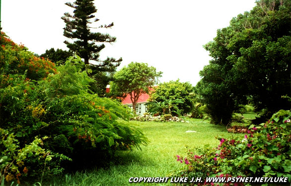
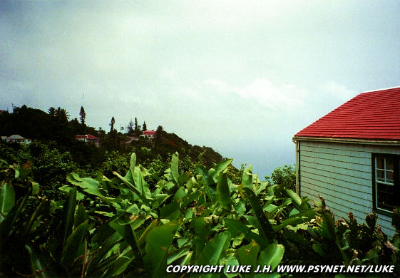
Saba |
Typical cottage-style house in Saba
Photo Copyright © LukeTravels.com
SABA -
TROPICAL ISLAND
Saba has a wide variety of flowering plants, ranging from the
prolific oleander and hibiscus that decorate its yards to the
wildflowers and orchids that thrive in the rainforest. Over sixty
species of birds are sighted on Saba, including bridled and sooty
terns, brown noddys, tropicbirds on the cliffs and frigatebirds near
the coast. Red-tailed hawks can be spotted on the lower slopes,
while thrashers and hummingbirds are found at higher elevations.
Saba is crawling with harmless racer snakes that sun themselves
along trails and roadsides. Expect to see the friendly little Anolis
sabanus lizard that's endemic to the island and to hear the tiny
tree frogs whose symphony can be almost deafening at night.
The average monthly temperature is 80°F, with few degrees difference
between summer (June to August) and winter (December to February).
Because of the difference in elevation, temperatures are a bit
cooler in Windwardside than in the Bottom.
Saba |
View from our cottage
Photo Copyright © LukeTravels.com
SABA -
HISTORY OF SABA
Because of the island's
rugged terrain, Saba was probably not heavily settled in
pre-Columbian times. However, artifacts uncovered in the Spring Bay
area indicate the existence of a small Arawak settlement at that
site about 1300 years ago.
During his second trip to the New World, in November 1493,
Christopher Columbus became the first European to sight Saba. The
Dutch laid claim to the island in 1632 and sent a party of colonists
from Sint Eustatius in 1640 to form a permanent settlement. These
early colonists originally lived at Middle Island and Mary's Point,
where a few cisterns and stone walls can still be found, but soon
moved to the Bottom, which remains the administrative center of the
island.
As the steep topography precluded large-scale plantations,
colonial-era slavery was quite limited on Saba. Those colonists who
did own slaves generally had only a few and often worked side by
side with them in the fields, resulting in a more integrated society
than on larger Dutch islands.
Until the 1940s, Saba's villages were connected solely by footpaths.
When Dutch engineers told residents the island's steep terrain
prohibited road building, they spent the next 20 years building one
themselves. Although Hurricane Georges rolled directly over the
island in 1998, no one was killed and damage was relatively light.
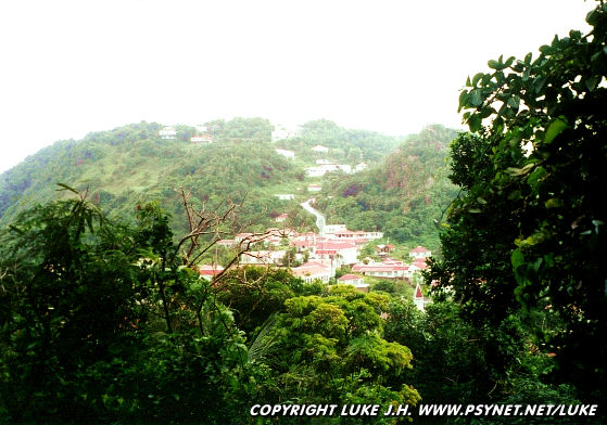
Saba |
Looking at Windwardside
Photo Copyright © LukeTravels.com
SABA -
ACTIVITIES
Saba's stunning scenery extends beneath the
surface, with steep wall drops just offshore and some good near-shore reef dives. Most of
the island's two dozen dive spots are along the calmer leeward (western) side, between
Tent Bay on the south and Diamond Rock on the north. Some of the more exciting dives
include Tent Reef Wall, which has colorful tube sponges and corals and lots of fish
activity; Third Encounter, where the coral and sponge-encrusted, 250ft tall 'Eye of the
Needle' towers above the floor; and Diamond Rock, which has a great variety of marine
life, including stingrays, black-tip sharks and bull sharks.
For snorkelers, Well's Bay and the adjacent Torrens Point are popular spots, and there's
even a marked underwater trail.
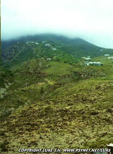
Saba |
Rocky part of the island
Photo Copyright © LukeTravels.com |
|
 |
The waters surrounding Saba are protected under the auspices of the Saba Marine Park,
which has undertaken a number of conservation efforts, including installing permanent
mooring buoys at dive sites. To help cover the park's operating expenses, a small marine
park fee is added onto each dive.
Saba is not the place to go if you want to lay out on sandy strands. The main swimming
spot is Well's Bay at the northwestern side of the island, which has a small, rocky beach.
All the island hotels have swimming pools.
Saba has excellent hiking. There are seven signposted hikes, ranging from a 15-minute walk
to tide pools just beyond the airport to a steep climb up through a cloud forest to the
top of Mt Scenery, Saba's highest point. Some of the trails, such as the Crispeen Track
between the Bottom and Windwardside, follow the old footpaths that linked the villages
before the first vehicle roads were built. A trail brochure and map is available free at
the tourist office in Windwardside.
1. Source: Saba Tourism.